The Ministry of Environment/Environmental Control Agency (KLH/BPLH) are reviewing whether large-scale renewable energy projects contributed to the recent catastrophic flooding across Sumatra, with plan to summon company leaders involved for clarifications and gather evidence as part of a preliminary assessment.
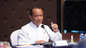
“There are activities that have altered the landscape,” Environment Minister/BPLH Chief Hanif Faisol Nurofiq said on Monday, December 1, 2025 following the ProKlim environmental awards ceremony in Jakarta.
While efforts are underway to restore affected ecosystems, KLH/BPLH is also preparing potential legal action against companies found to have violated environmental regulations. To strengthen the environmental review, the ministry has requested assistance from universities in Aceh, North Sumatra, and West Sumatra ahead of field investigations.
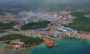
A report by the Mining Advocacy Network (Jatam), dated November 28, 2025, highlighted concerns specifically related to the Batang Toru hydropower project in North Sumatra. According to the report, at least 56.86 hectares of forest along the Batang Toru ecosystem have been cleared for main facilities, reservoirs, access roads, and supporting infrastructure.
In its assessment, Jatam argued that hydropower projects of such scale may significantly modify river flow, alter sediment patterns, and increase the risk of downstream flooding or landslides ‒ especially when extreme rainfall coincides with inadequate dam management.
Across Sumatra, there are currently 28 hydropower (PLTA) projects planned or under development:
● 16 in North Sumatra;
● 5 in Bengkulu;
● 3 in West Sumatra;
● 2 in Lampung;
● 2 in Riau.
Additionally, eight geothermal power plants (PLTP) are already operational, alongside active survey and exploration areas for future development. Jatam warned that full-scale operations in these geothermal zones could heighten disaster vulnerability due to land clearing, drilling activities, and soil disturbance ‒ particularly in steep terrain.
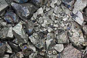
These risks, the organization added, are compounded by extensive mining operations across Sumatra. Mineral and coal industries currently occupy about 2.45 million hectares, divided into 1,907 permitted concession areas.
The environmental investigation will continue as authorities work to determine the extent to which infrastructure development has intensified the region’s exposure to floods and landslides ‒ and what accountability measures may follow.
Already have an account? Sign In
-
Start reading
Freemium
-
Monthly Subscription
20% OFF$29.75
$37.19/MonthCancel anytime
This offer is open to all new subscribers!
Subscribe now -
Yearly Subscription
33% OFF$228.13
$340.5/YearCancel anytime
This offer is open to all new subscribers!
Subscribe now
Set up email notifications for these topics