The Ministry of Agrarian Affairs and Spatial Planning/National Land Agency (ATR/BPN) is targeting completion of mapping of all land areas in Indonesia by 2025.
Currently 121.3 million areas have been mapped, while 95.7 million areas have been certified of the total 126 million land areas that are the responsibility of the Ministry of ATR/BPN.
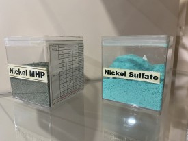
"The completion of this mapping is expected to minimize conflicts and land disputes that are still complex problems in Indonesia," Deputy Minister of ATR/BPN Ossy Darmawan said while addressing the 8th anniversary commemoration of the Indonesian Nickel Miners Association (APNI) in Jakarta, on Thursday, March 6, 2025.
He highlighted the importance of the Suitability of Spatial Utilization Activities (KKPR) in supporting investment and licensing, while emphasizing that the acceleration of the completion of the KKPR is highly dependent on a detailed and accurate digital spatial plan.
"Currently, a map with a scale of 1:5,000 is only available on Sulawesi Island. If this map can cover the entire territory of Indonesia, the KKPR licensing process will be easier and more transparent," Ossy said.
He expressed hope that President Prabowo Subianto's attention on the issue would support the acceleration of this mapping, so that it can increase the efficiency of the licensing process and support the business world, including the Indonesian Nickel Miners Association.
With the completion of the mapping and improvement of the digital-based licensing system, the government is optimistic that it can create legal certainty for land and increase investment in the mining sector and other sectors.
Already have an account? Sign In
-
Start reading
Freemium
-
Monthly Subscription
30% OFF$26.03
$37.19/MonthCancel anytime
This offer is open to all new subscribers!
Subscribe now -
Yearly Subscription
33% OFF$228.13
$340.5/YearCancel anytime
This offer is open to all new subscribers!
Subscribe now
Set up email notifications for these topics