Ministry of ATR/BPN probes certificate ownership in Tangerang sea fence case
The Ministry of Agrarian Affairs and Spatial Planning/National Land Agency (ATR/BPN) is conducting an investigation regarding the Land Ownership Certificates (SHM) and Building Use Rights Certificates (SHGB) in the sea fence area of Kohod Village, Tangerang Regency, Banten.
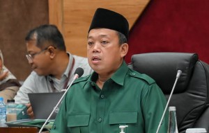
Minister of ATR/BPN, Nusron Wahid, said he has instructed the Director General of Land and Spatial Survey and Mapping (SPPR) to coordinate with the Geospatial Information Agency (BIG) to ensure the position of the certificates, whether they are inside or outside the coastline.
This investigation is taken after a polemic arose regarding the status of land ownership in the area.
An Attorney for Agung Sedayu Group, Muannas Alaidid, said that the plots stipulated in the SHM and SHGB owned by the group refer to areas that were originally soil, in the forms of ponds and rice fields that were later on abraded by sea water.
According to him, the documents of certificate application issued since 1982 show that the area used to be a divided land, before being transferred to PT Inti Cahaya Sentosa, a subsidiary of Agung Sedayu Group, through an official process.
"All SHGB and SHM were issued through legal procedures. The land was purchased from residents, transferred to another name, and accompanied with tax payments and complete location permits," Muannas said in a statement on Thursday, January 23, 2025. He also said that several SHMs in the area are still owned by residents.
Geospatial data
Nusron Wahid cited that coastline data from 1982 to 2024 would be the main reference in the investigation.
"If the results find that the certificate is outside the coastline, an evaluation and review will be carried out," Nusron said.
He also revealed that to date there have been 263 certificates issued at the location, consisting of 234 SHGB in the name of PT Intan Agung Makmur, 20 SHGB in the name of PT Cahaya Inti Sentosa, and nineplots owned by individuals. In addition, 17 SHM plots belonging to residents were also found.
Agung Sedayu clarifies
Muannas said that the allegation that the entire 30-kilometer sea fence area was certified for PT PIK, another subsidiary of Agung Sedayu Group, was not true. He asked all parties to refer to available data, by among others browsing Google Earth to see the position of the plots at the location.
This investigation is expected to provide legal clarity regarding the status of land in the Kohod Village sea fence area, as well as ensure transparency in the issuance of certificates.
Already have an account? Sign In
-
Start reading
Freemium
-
Monthly Subscription
30% OFF$26.03
$37.19/MonthCancel anytime
This offer is open to all new subscribers!
Subscribe now -
Yearly Subscription
33% OFF$228.13
$340.5/YearCancel anytime
This offer is open to all new subscribers!
Subscribe now


